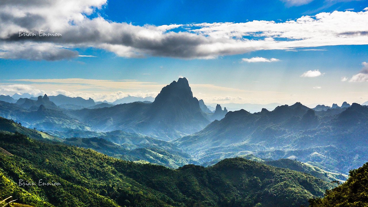
I decided to make it a three-day long weekend trip to Sangkhlaburi. With the rainy season holding on longer than usual this year, it seemed like the perfect opportunity to check out the waterfalls in the area. Once the rains stop and the cool dry season arrives, the waterfalls aren’t nearly as impressive.
On Sunday, I thought I’d head up to Three Pagodas Pass and visit a couple of waterfalls along the way. These waterfalls are located in the Thung Yai Naresuan Wildlife Sanctuary.
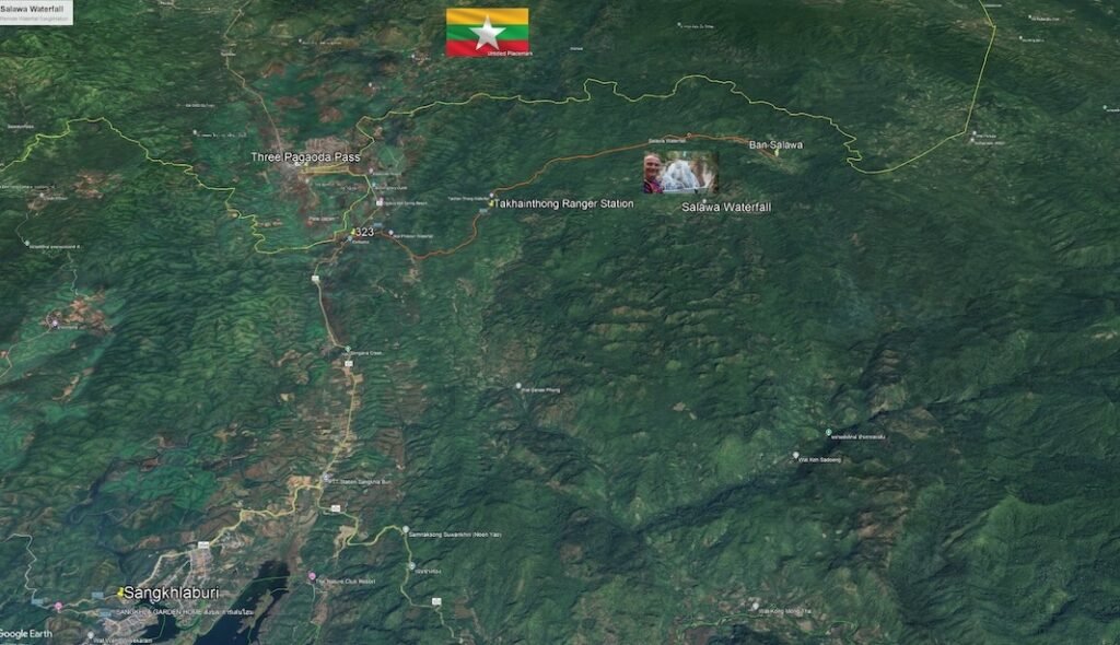
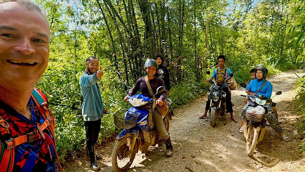
The first picture below shows the route. Head towards Three Pagodas Pass, then turn off at the sign toward the Takhainthong Ranger Station. When I arrived, the rangers told me there were two waterfalls I could visit. They pointed me toward the boom gate, so I ducked under and started my journey.
(In hindsight, after getting back, I believe I misunderstood and overshot the actual waterfall I was supposed to visit—which was actually very close by the entrance)
I rode along the dirt trail, passing local Karen people along the way. Every so often I’d stop and ask for directions in Thai: “How far is the waterfall?” I got some very strange looks and broken Thai responses, as the people here are Karen. Depending on who I asked, I was told anywhere from 1 or 2 km to 6 km. So I pushed on.
Keep in mind, this was just supposed to be a casual ride—I was only wearing my helmet, shorts, and a t-shirt. I wasn’t expecting to go deep into the wildlife sanctuary.
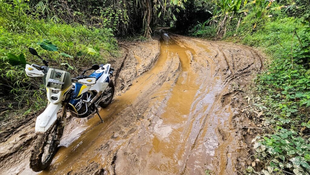
There were some steep hill climbs and sections of mud and churned-up clay soil. I followed the locals’ line and managed okay. Then I stopped again to ask for directions, got more bemused looks, and was told it was a few more kilometers.
Now the track was getting muddier and muddier under the tree canopy. I pushed on, mindful of my sandals, shorts, and t-shirt—hardly proper riding gear. I was ready to jump off at the slightest hint of the bike going sideways.
Then I hit this really big, long mud bog. You could see where others had gotten stuck. Even while I was sizing it up, locals pulled up and started getting stuck themselves.

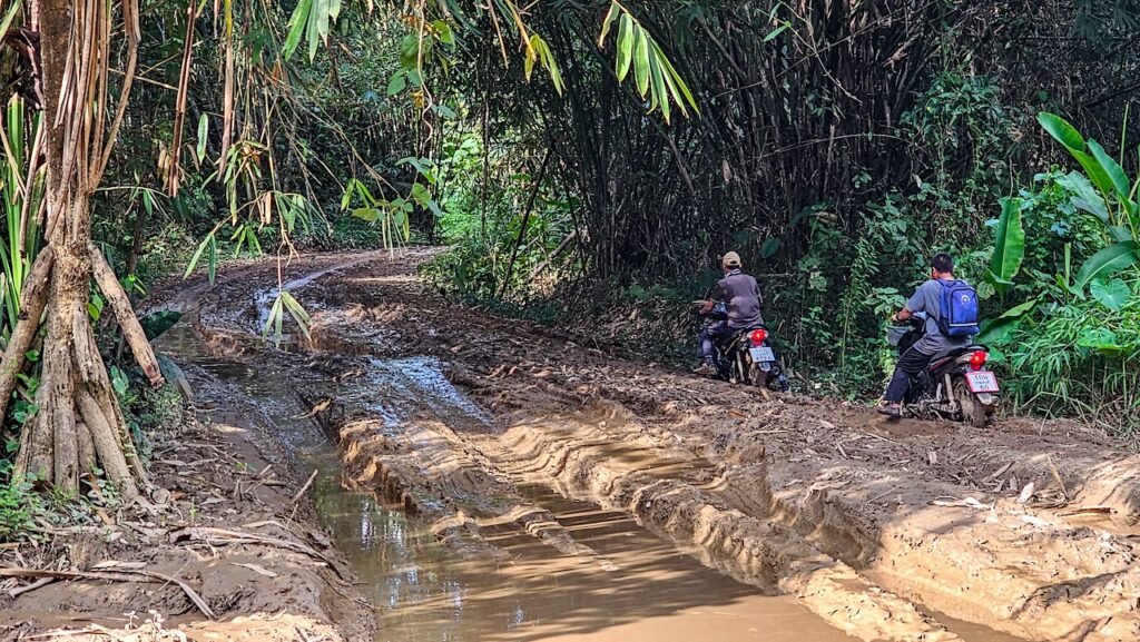
Nope, not this time in my sandals and shorts. I’d save this for another day and head back.

I got about 400 meters back when one of the locals I’d passed earlier stopped and talked to me. “You’re nearly there. It’s only around 1 km away. OK, I’ll follow you through the mud bog.”
Sure enough, I got stuck—jumping back and forth, lots of throttle, and a mud shower all over me from the rear wheel spinning. But we pushed through and came to another small ranger station. He went and talked to them while I waited. I think he was confirming how much further to the waterfall.
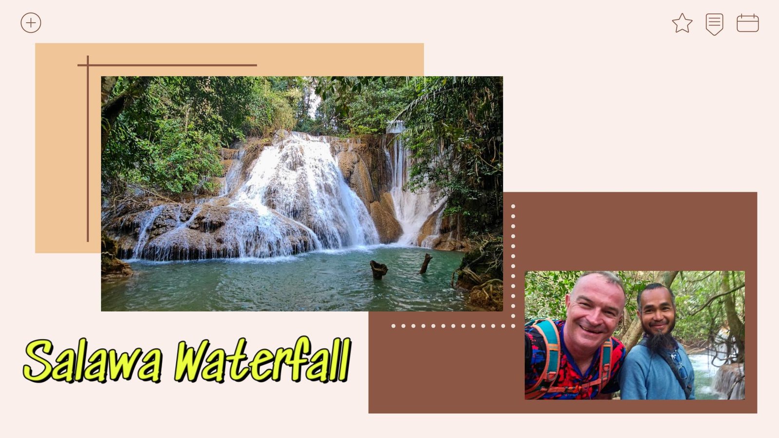
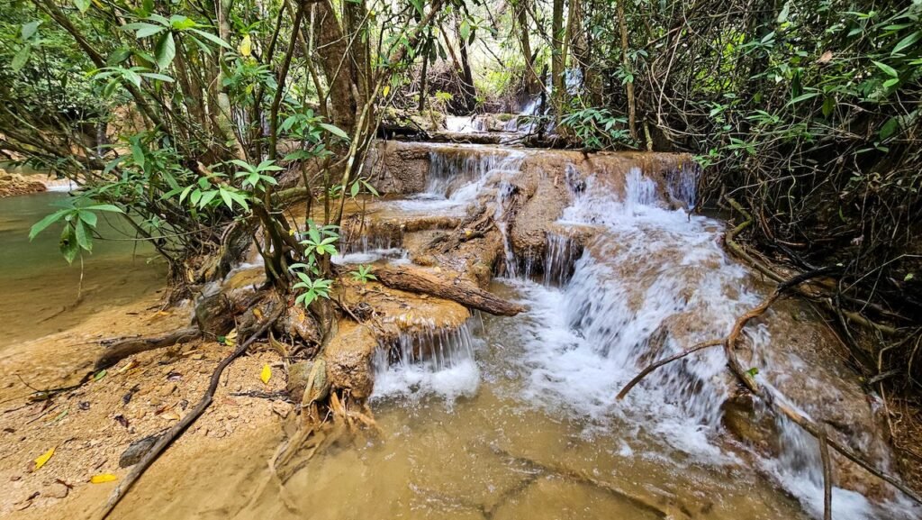
We pushed on, then stopped. We could hear the waterfall raging but couldn’t find a good way down. Then a bunch of locals turned up and we talked with them. Turns out the trail down to the waterfall was back about 200 meters.
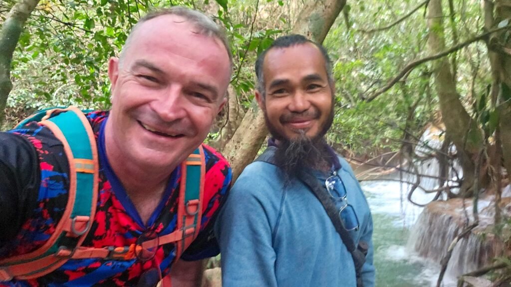
Picture with the locals on the trail—everyone was so surprised to see this foreigner out here. Big smiles all around and super friendly.
We went back and found the spot, which was really just a small trail and clearing. Nothing to indicate this was the way to the waterfall.
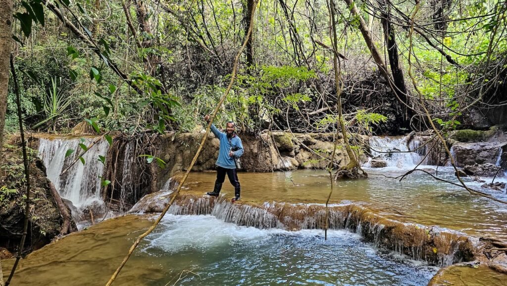
We made it down to the bottom, then started rock climbing up the first tier. Rock climbing is not my thing, and I’m a bit of a wimp when it comes to heights.
My new friend encouraged me, and we climbed up the first tier, then the second, then the third, and so on until we reached the top level—scrambling, holding onto whatever we could, with his support when I needed help getting up rock faces higher than me. Not for the faint of heart, and definitely not something I would have or could have done alone.
Time to start the climb up.

Looking for a way up to the next tier of the waterfall
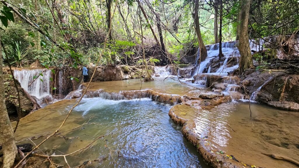

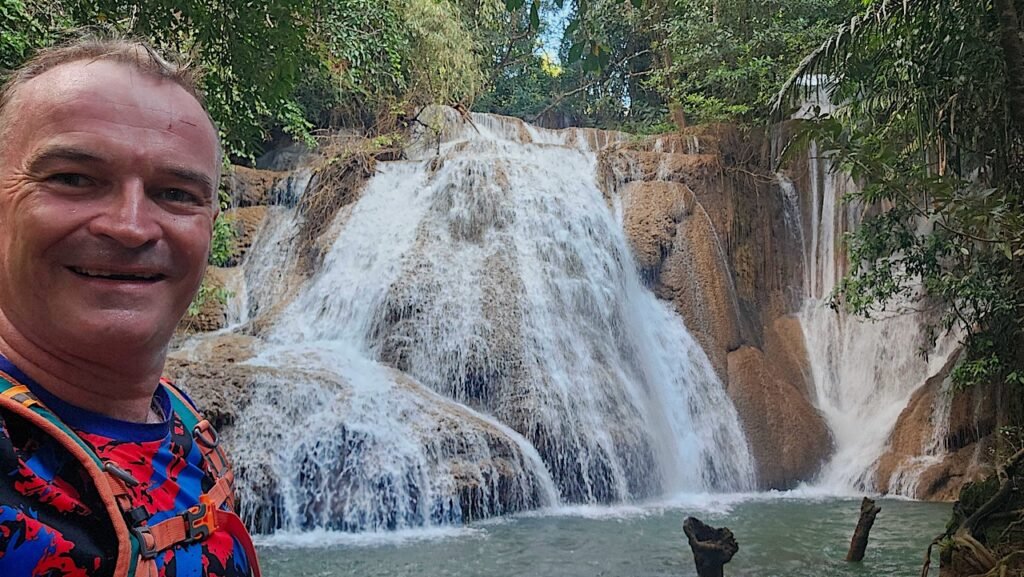
We made it to the top tier of the waterfall

Truly amazing experience. Maybe I should suggest this as the next work team-building activity. 😉
We got back to the bikes and took photos of each other’s Facebook names since there was no signal out there. He headed on to his village, and I started back the way I came.
Baan Salawa (Salawa Village) is about 3 km further up the trail. Had it not been getting late in the afternoon, I would have continued on. I really wanted to make sure I was out of the bush before dark.
When I passed the smaller ranger station about 1 km back, both rangers looked up with big grins and gave me thumbs up.
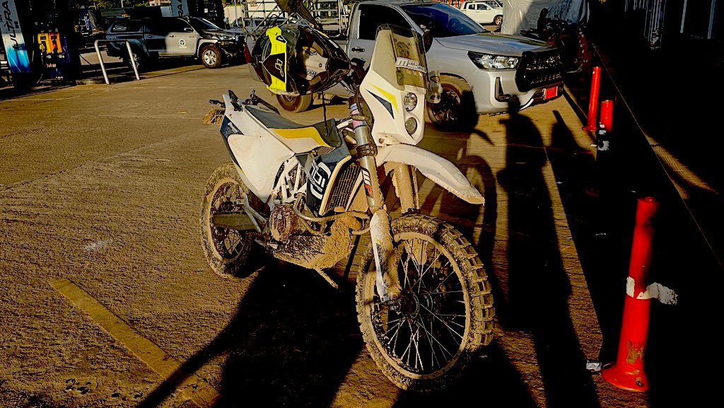
Back through the big mud bog without getting stuck this time.
About halfway back, a 4×4 stopped and the driver waved his arms at me, apologizing that this wasn’t the way and that the waterfall was closed. Well, I’d just been there! We both laughed, he apologized again, and we carried on.
I’m not sure if he came looking for me because I hadn’t returned and had overshot the closer waterfall. It had probably been close to three hours since I’d passed the ranger gate.

I made it out to the main road, did a quick run up to Three Pagodas Pass for a visit to the tax-free booze shops, then headed back to Sangkhlaburi.
What an amazing afternoon—one I’ll remember for a lifetime. Big thanks to the local Karen people and rangers I met along the way, and of course my new friend who helped me and encouraged me all the way up the waterfall to the top tier.
YouTube Video
Google Maps
https://maps.app.goo.gl/XRGYUi6XV7358csk6
GPS Coordinates
15.350043868977187, 98.49611540314956
Bloody brilliant Brian.🙂👍
Looks nice. Confused why the Karen would give you or anyone for that matter strange looks or broken Thai responses. Karen speak Thai. Otherwise, they wouldn’t be able to communicate with anyone else. I’ve met many Karen in various parts of the border and they’ve all been very friendly and speak Thai (of course) although some of the older generations don’t speak it that well. In general, I find Karen more nonchalant than Thais from other parts of the country. They are friendly, though shy. They generally won’t make a fuss or act overly curious if they see someone or something unusual.
Strange look, as I had gone much further than I was supposed to.. Accidentally. You need a permit to get in to that area. So most likely why I had the strange looks as not expecting to see a Farang on a Husqvarna 701 that far in asking for directions to a waterfall.
While the younger generation are much better. There are still many more remote areas where they don’t speak Thai at all. In Kanachanburi it seems better. But when you go up Sop Moi and Salween National Park. There are plenty not speaking Thai and plenty that do. Just depends on the location and if they have a school nearby. Most of the communities with Schools I have seen are run by the Border Patrol Police in the more remote border areas.
In this case they were 40 and above years old that were passing me.. hence most likely the lack of Thai language or limited. You can see in the video the guy that showed me the waterfall spoke Thai well.
Yes very friendly. I have some Karen friends that live up in Sop Moei and just went to the village last weekend for a wedding and stayed two nights.. Solar power, no mobile signal. They speak Thai mostly and OK, but even some of them it took a few goes to properly understand with the middle ages ones and above. The youth under 30 mostly OK.
Brian