
It has been quite a few years, many years since I did this ride from Luang Prabang to Phonsavan.
It is still a ripper. Only 220 or so KM if you don’t take too many wrong turns.
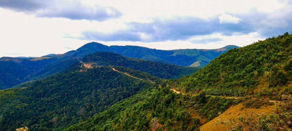
A long day through the winding mountain tracks and roads with some pretty long and steep climbs in places.
Fellow Aussie Craig rode up to meet me in Luang Prabang and do some riding together.
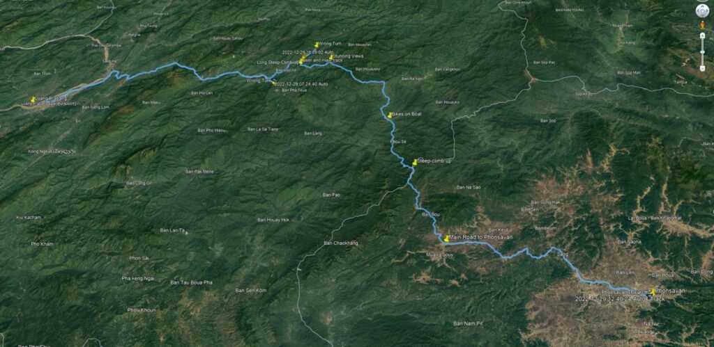
The route we took. You will need to zoom in to see the yellow marker names.

Loaded up and ready to go early morning in Luang Prabang.
( Those Revit dirt bike pants are great. Not as much knee protection as I would like. So put my trail riding knee guards on underneath, perfect ).

Well spotted Craig. Nice shot. Not often you see Elephants in Laos these days. Not even working Elephants.

We finally leave the sealed road and are on the dirt roads.
Note Fuel :–
Fill up with fuel when you reach the next big town after leaving the tarmac.
There isn’t much in the middle and you will be good all the way to Phonsavan.
If you run out and are late getting to the main road. All the petrol stations are closed until you reach Phonsavan.
You can find fuel in the middle, but I prefer not to have this worry. My fuel light came on 8 km from Phonsavan. So no issues at all.
The GPS was confused or so it seemed. Go left along the river or right up the mountain?
I took right and up the mountain as the GPS was kinda stuck in between both.
Wrong. Steep, bull dust and as we make it up the GPS corrects itself.
Turn around and back down we go.
I managed to cook the rear brake on the way down. So cooled it off at the bottom of the mountain.


We bought some cakes etc., at the night market in Luang Prabang.
Looking for a nice spot to stop and have breakfast along the way.


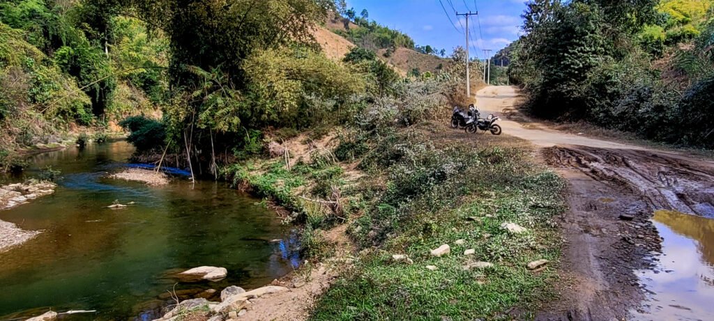
Starts to get really nice and scenic and not too much dust. But there is still enough to get up your nose and in your helmet.


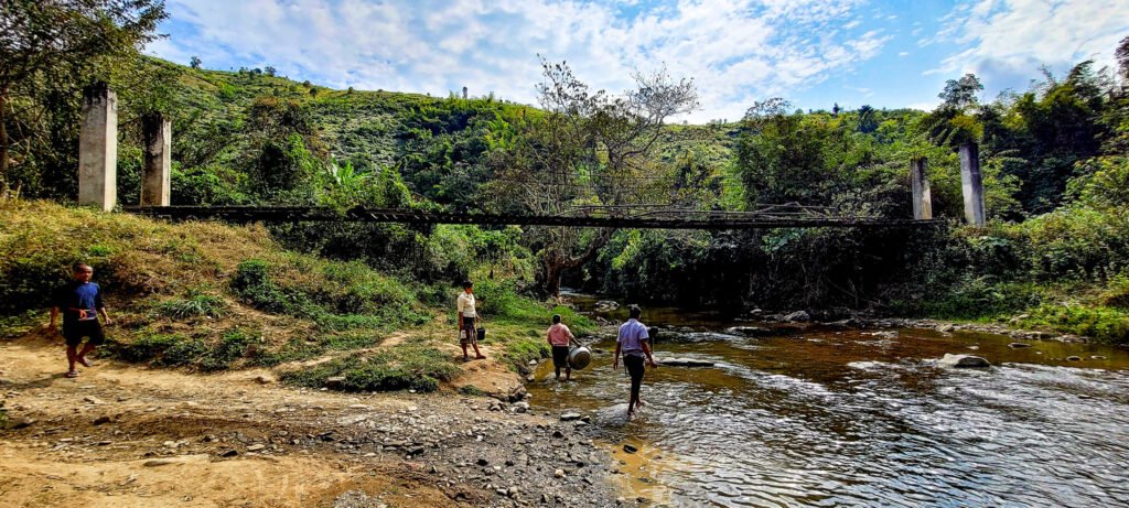
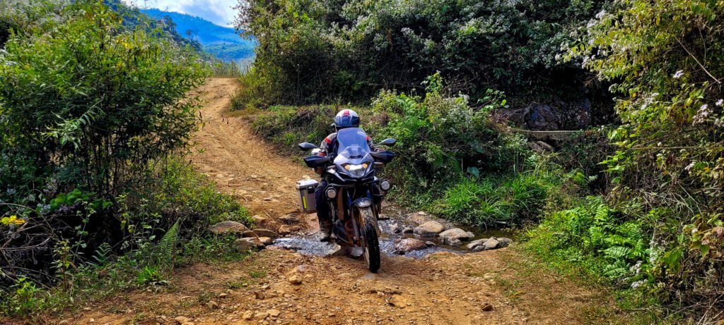
We ride through this creek and stop at the village to take some photos.
Great timing. The village had just slaughtered a pig and are washing and cleaning it in the creek as we arrived.
Super friendly people.
They warned me, not to ride over the bridge. After we had ridden through the creek on the way in luckily.
The bridge is not in a good way for more than walking or scooters.


Thumbs up from this lovely lady upstairs.
Made her the cover photo for the video and this post.
Next time I come through here. Going to bring her a copy of this photo.

I managed to miss the turn off later on.
We go all the way to the end. A villager comes out and can see what we have done.
Directs us back. I can see the mistake on the GPS and off we go again.
It wasn’t much of a turn off either, more like a side entrance to a farm with ruts that could swallow the bike to the right of the trail to the first creek.
Nice in here on the wrong trail and happy for missing the turn off.
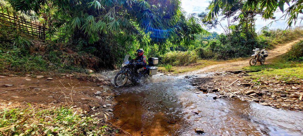
We find the turn off and after the steep rutted down hill, some creeks to cross.
Opps. I get off and go back and help Craig.

This smaller track between the two main tracks was a bit tricky on the Versys X.
The track up is a lot steeper with longer rocky section than the photo illustrates.

After the rocky climb, we are greeted with this fabulous view.
A local comes screaming down on his scooter. I wave and yell at him to slow down. Pretty sure he was on the same line as Craig, but neither could see each other around the bend.
He slowed down just at the bend and sure enough was on the same line and went around Craig.
The trail comes out at the top of the mountain to the left of the photo above.
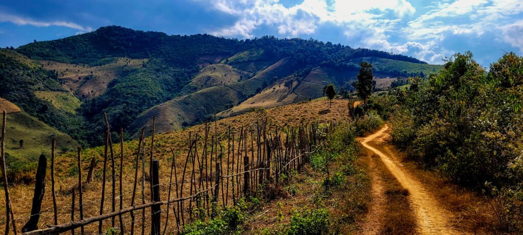
Long tight and steep mountain climb in places, up to the main track that the cars and trucks go on.
I guess you could say it is a local short cut. Not sure cars would get through easily with out some serious damage to the paint work at a minimum. Imagine being in a 4×4 and another vehicle comes the other direction and you are climbing up one of the steep parts.
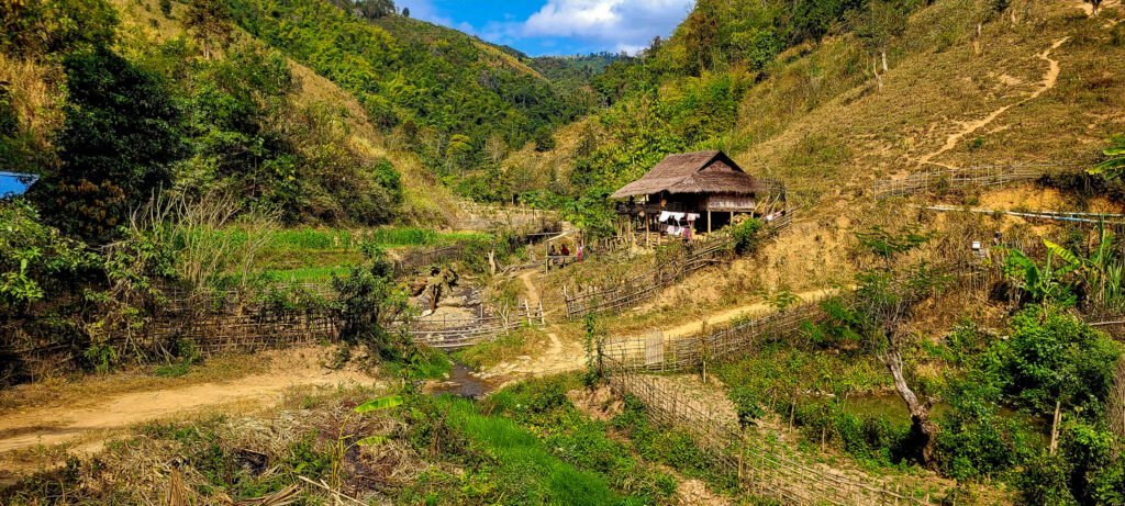
Up the top of the shortcut we pop out at this village on the main track.

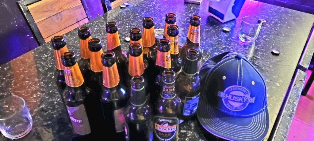
Beer O’clock with some eagle eyes watching my every sip.

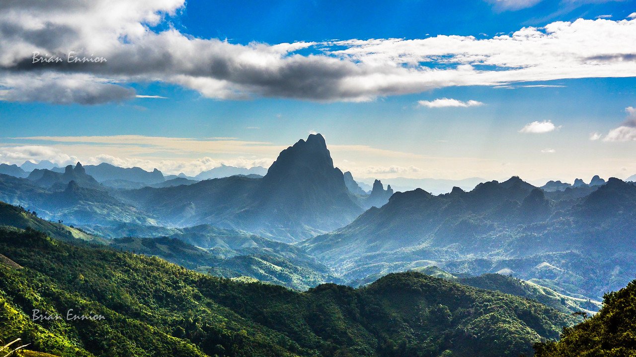
More stunning views. Not much changed in here over the years.


Many parts of the main track are very rocky. No loose rock, but rock bed in the earth to assist the vehicles. This became tiring after a while. Probably for traction in the rainy season.

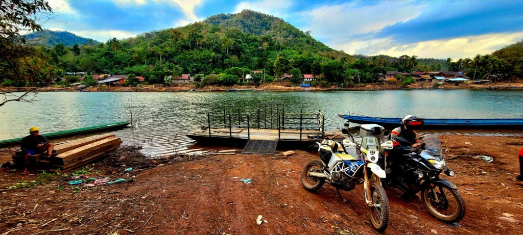
Time to cross the river. A bit of piracy with the rate charged.
But it is getting late and we are not going back.

A steep and long climb up and over the mountains after the river crossing.
I don’t know why, but my memory had it as all flat after one more climb after the river.
My memory was wrong. It wasn’t too hard as the track had been fixed up in the last couple of months. Some wash outs here and there and very steep.. Up up up up and up and then some steep bits with loads of gravel and rocks. Again, not hard, just tiring after a big day and the light is going fast in the mountains. The highest point was just shy of 1600 metres above sea level after the river crossing.
Reach the main road to Phonsavan in the dark. Night riding from the main road to the hotel.
My hands are so cold, the temps really drop up at this elevation as well as the wind chill from riding.
Wind chill, dark, potholes out of nowhere and big parts of road missing along with cattle wondering across the road, trucks and cars throwing up dust in the mix.
I am shivering and couldn’t hold the pen to sign the hotel registration book.
Much to the amusement of the staff.
This is a good hotel and only 200,000 kip per night. Safe and secure parking, clean, nice rooms, walk to everything in town. But the rooms are cold this time of year.

YouTube
Luang Prabang to Phonsavan Off-road
Beers with David.
I am wearing my rain gear to keep warm. It is 10 c outside
Inside they had the A/c set to 28c LOL


Next morning off to the market to buy some winter clothes

A rumble around town and enjoy some of the Hmong New Year festivities still going on

The next day we are up early and off to Vang Vieng via Long Chieng
Cheers.
your reports are invaluable to a rookie wannabe offroader – really clear explanations of the trials and tribulations awaiting the unwary. I want to do these sorts of trips shortly but need to do it with an experienced person such as yourself – so much to see but need to have the riding skills & knowledge (and fall prevention skills) before getting too far off-road. your reports will become my guides! cheers mate